Historic maps
Browse these subjects to locate historic maps
Find historic map images in books
Use the same subjects listed above but change the search to a keyword search, adding the word pictorial to locate heavily illustrated works
example: Cartography history pictorial
Recommended Titles
David J Weber Series In The New Borderlands History
The mapping of North America : three centuries of map-making 1500-1860 / John Goss
Cartographia / Vincent Virga and the Library of Congress ; introduction by Ronald E. Grim
An atlas of rare city maps : comparative urban design, 1830-1842 / Melville C. Branch
Blaeu's The grand atlas of the 17th century world / introduction, captions, and selection of maps by John Goss
Cartographica extraordinaire : the historical map transformed / David Rumsey, Edith M. Punt
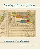
Timelines
Browse these subjects to locate timelines
Chronology - historical tables
For other time-related graphic representations
Related websites
David Rumsey Map Collection
The collection focuses on rare 18th and 19th century North American and South American maps and other cartographic materials. Historic maps of the World, Europe, Asia, and Africa are also represented.
Historical Map web sites offers links to historical map sites as well as individual maps - compiled by the University of Texas.
Library of Congress, American Memory Map collections
LOC, Geography & Map Reading Room
Indian Maps, Mapping, and Geographic Knowledge
Native American Spaces: Cartographic Resources at the Library of Congress.
See also, Indian Maps, Mapping, and Geographic Knowledge
World Digital Library - maps
Browse by type of item then refine searches by place, time, topic, or institution + search in 7 languages.
History of Cartography (volumes 1-3) University of Chicago Press

